Geological exploration work on the Horní Město deposit
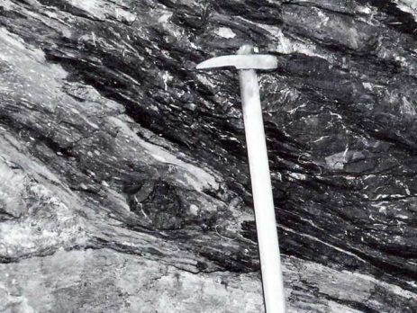
The Horní Město ore district is located in the southern part of the Vrben series. This is affected by Variscan folds and regional metamorphism, so its structure is very complex. In the vicinity of Horní Město, the Vrben series is divided into eastern and western parts by the vault of the Bedřichov gneiss. The eastern part stretches from Nová Ves through Horní Město and Ruda further to the SW. Near Horní Město, it has a width of about 3 km and is built in a sequence from bedrock to bedrock with basal conglomerates, graphitic phyllites and quartzite inserts, an epizonally metamorphosed effusive assemblage of sericitic-chloritic schists and effusions, or intrusions of acid eruptions — keratophyres. Angelic layers follow further into the overburden. The mineralization of non-ferrous metals is stored in the keratophyre body, which stretches under the municipality of Horní Město, and in the seric schist overlying this body. In depth and towards the SW, this body breaks up into less powerful positions, alternating with parts of keratophyre tuffs. Sericitic and sericitic-chloritic slates form bands that cross directionally and dip into each other and dip to the SE at a dip of 30-70°. The entire Middle Devonian Horní Město Formation is affected by sericitation in the deposit area. The bands of sericitic schists were probably formed by metamorphism of tuffitic emplacements. Sericitic schists at the contact with keratophyres may have originated in contact metamorphism.
As a rule, parts near the contacts of sericitic slates with keratophyres are mineralized. Directional dislocation bands are formed at the junction of these rock types. The filling is different (vein quartz, feldspar and carbonates, tectonic clay or mylonite). During the tectonic mapping of the mine workings, several transverse and transversely oblique dislocations in the ESE – WSW direction with a steep inclination to the NNW were detected. Dislocations are filled with tectonic clay and mylonite. The movement of the rock is visible in some places, and the rupture of the deposit occurred only in the event of a fault on the Josef tunnel near the 2109 a. trench. There are relatively frequent, but not significant, cracks on the deposit.
Places where several fault systems intersect are particularly relevant for mining. In those, there was a greater subsidence of the overburden, and it was necessary to leave the lost pillars during the excavation work.
A systematic geological survey took place at this location in the years 1954 – 1964. Through deep drilling, ore deposits were found in a length of 1,400 m, to a depth of 300 m below the surface, the deposit was subsequently opened by the Jaromír shaft in 1956 with the mining works carried out, the south-western part was opened up with a Joseph adit in 1957 and the New shaft to the level of the 3rd floor in 1960. The deposit was broken up by horizontal parts on 4 horizons, i.e. the 1st, 2nd, 3rd floor and the tunnel horizon of the Joseph adit. Rudné doly, n.p., Jeseník took over the deposit from the Geological Survey, n.p., Brno by handover protocol dated April 1. 1965. A number of buildings were built on the surface, necessary for the realization of mining plans. Preparatory work was underway in the mine.
The geological survey was evaluated in detail in the reserve calculation, which was prepared as of 1/8/1963, and in this calculation the following reserves were evaluated:
Balance sheet: 1,855,0001 t of ores in categories B+Ci+Cj
Off-balance sheet: 2,736,0001 t of ores in Cj+Ca categories
The metallicities of ores vary from tenths of % Zn and Pb to exceptional contents of around 12% Zn and 5% Pb. Ag contents vary greatly from 1 – 80 g/t Ag.
The average width of the deposit zone is 95 m. The zone contains 6-9 ore positions, stretched in a cigar-like fashion around the horizontal. The deposits form continuous ore positions, but they are not balanced throughout. The deposits generally continue for a greater distance, but the sulphides of lead and zinc gradually disappear until pyrite completely predominates.
Individual ore locations can be classified into two types:
1st type: The deposits are deposited within the sericitic schist complex and at the contact of smaller keratophyre bands. They are usually sharply demarcated in relation to the subsoil and overburden. The ore consists of fine bands of sphalerite, galena, and pyrite, deposited conformably with the surfaces of sericitic slates.
2nd type: The deposits are deposited in keratophyres, the ore has the character of a vein consisting of a dense network of fine veins. In places the ore is concentrated in irregular clusters or nests.
The power of the bearing fluctuates within large limits. The deposits of the first type are 1-6 m thick, the deposits of the second type locally reach a thickness of up to 15 m, the average is 4 m. The thickness of both types varies with gradual transitions. The inclinations of type 1 bearings range from 40 to 60° (Jaromír pit). Bearings of the 2nd type are placed steeply under an inclination of 70 – 85°. Cigar-shaped irregular bodies sometimes even have lobed contours.
The main ore minerals were pyrite, sphalerite and galena. Chalcopyrite and arsenopyrite were minor sulphide minerals, accessories include tetrahedrite, proustite, pure Ag, molybdenite, pyrrhotite, rutile, ilmenite, leucoxene, magnetite and hematite. Of the tailings minerals, quartz, muscovite, albite, calcite predominate, and fluorite is rare. Crystallization of ore and tailings components probably took place over a longer period of time. Apparently, part of the ore solutions had the nature of colloidal fluids or the environment corresponded to the mixing of hydrotherms with sea water.
Source: http://www.zdarbuh.cz/reviry/rd-jesenik/geologicko-pruzkumne-prace-na-lozisku-horni-mesto/